Marinas we dive
Madeira Beach Marina, and the water it lives in.
Cut open in 1848John's PassCity-owned
Marinas we dive
The water
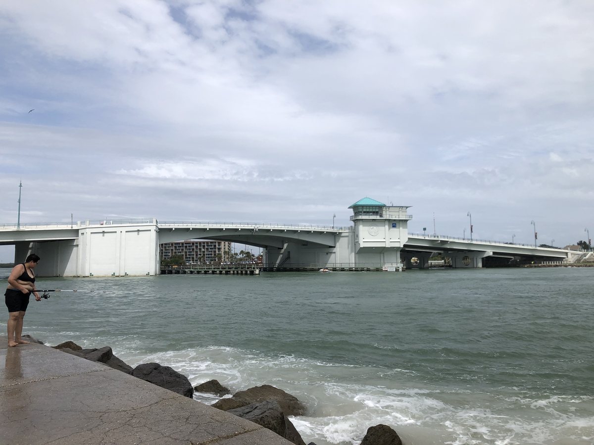
On 27 September 1848, a Category 4 hurricane made landfall at the mouth of Tampa Bay and rearranged the coastline. It flooded most of the Pinellas peninsula, destroyed the year-old Egmont Key lighthouse, and sliced a new opening straight through the barrier island between what are now Madeira Beach and Treasure Island.
Two turtle traders, John Levique and Joseph Silva, were sailing home from New Orleans and had ridden out the storm along the coast. Looking for a familiar way back into Boca Ciega Bay, they found an opening that had not existed a week earlier and sailed through it. It has been John's Pass ever since.
The same storm is the reason Maximo Point lost its fishing rancho that autumn. One hurricane, two ends of the same county, two entirely different outcomes — it erased a working port at one end and created one at the other.
The pass runs roughly 150 feet wide and 10 feet deep. The first bridge crossed it in 1927, was replaced in 1971, and replaced again in 2013.
1.6 miles from John's Pass is close enough that the season does most of the forecasting for you. Predictable water is the easiest kind to schedule around.
Madeira Beach Marina, Madeira BeachMadeira Beach Marina lies about 1.6 miles from John's Pass, with Blind Pass roughly 5.8 miles off. It is close enough to the inlet to feel it, and that distance is the single best predictor of how fast a hull fouls here.
Close to a pass, tidal exchange still reaches the berth but has lost some of its force. Growth is mixed rather than dominated by one thing, and it follows the season more predictably than water further in.
A private marina with a settled fleet gives us the most useful thing possible: the same hulls over time, so the cadence gets sharper with every visit.
Timeline
The army opens a rest post on Clear Water Harbor. The peninsula is still barely settled.
A lighthouse is built at the mouth of Tampa Bay. The Great Gale destroys it the same year.
A Category 4 hurricane makes landfall at the mouth of Tampa Bay and cuts a new inlet through the barrier island.
Returning from selling green turtles in New Orleans, they sail through the new opening into Boca Ciega Bay. The name sticks.
Both men claim 160-acre federal land grants on condition they settle the ground around the pass.
A two-lane drawbridge finally spans the pass, nearly eighty years after it opened.
The crossing is replaced twice more as traffic and vessel size grow.
Wilson Hubbard persuades the City of Madeira Beach to build a boardwalk at the pass. It now runs 1,100 feet.
Things worth knowing
Distance to the nearest inlet is the strongest single predictor of fouling rate. At 1.6 miles from John's Pass, with Blind Pass a further 5.8 miles off, this berth sits well within reach of it.
City-owned, near John's Pass. Madeira Beach, on Boca Ciega Bay, 1.6 miles inside John's Pass — well within our regular run.
Growth in Pinellas is not linear, and at 1.6 miles in the seasonal swing is pronounced but predictable. A cadence set for August will be wrong in January.
Bare metal fouls faster than painted surface everywhere on this coast, and in moving water it is relentless. Props, shafts and struts usually signal the timing before the paint does.
Manatees, dolphins and grass beds share Boca Ciega Bay. Method matters as much as schedule — media matched to the paint, and nothing scoured into the bottom.
508 Google reviews at 4.7 stars puts this among the busier facilities we cover, and busier basins mean more hull traffic moving growth around.
From the diver
Boca Ciega runs shallow and warm, and warm shallow water grows things. Expect a real barnacle set from May through October and a heavier slime layer than you would see in open Gulf water.
Flushing is the variable that matters most. A slip near the mouth of a canal turns over far more water than one at the dead end, and two boats a hundred yards apart can foul at noticeably different rates.
Because growth here is fast rather than gradual, cadence beats intensity. Frequent light cleans hold the paint far better than waiting for a heavy set and then scrubbing hard to catch up.
Gallery


We dive Boca Ciega Bay and know how it behaves through the season. Tell us the boat and the slip and we'll send a number and a cadence that fits the water it actually sits in.